Open menu
Civic Worth is in beta. It’s assembled automatically from public records and can be wrong. Check the official source before you rely on it, and tell us what’s wrong, or see what we’ve corrected.
Blog
Notes on parcel-resolved civic data, Columbus zoning, and what a specific address really means.
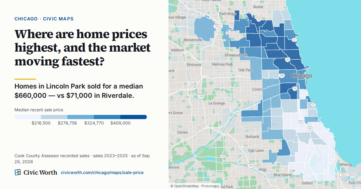
Why a $660,000 Median in Lincoln Park and $71,000 in Riverdale Isn't the Whole Story
Chicago's sale-price map shows a median $660,000 in Lincoln Park versus $71,000 in Riverdale; this post walks through how to read that gap properly, by checking the building, the zoning, and the wider pattern instead of treating one number as an explanation.
Read →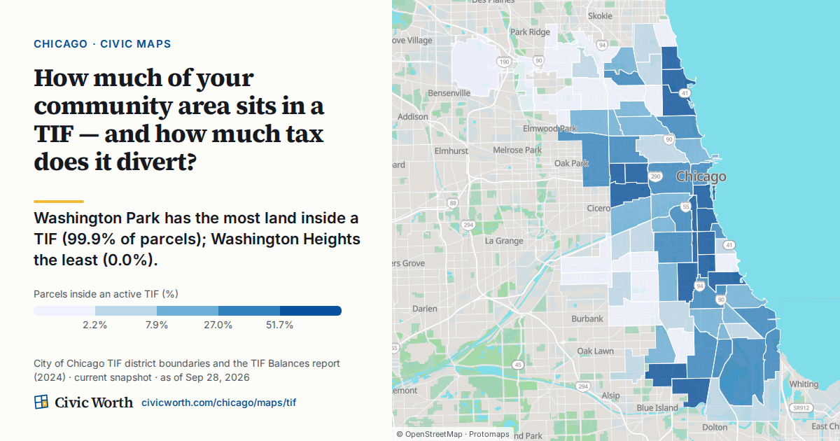
How to Read Chicago's TIF Map: What It Means for Your Property Taxes When Your Neighborhood Is in a TIF District
A plain-language walkthrough of how Chicago's TIF districts freeze the tax base and send the growth to a district fund, what that does and doesn't do to your tax bill, and Civic Worth's TIF map, where Washington Park has 99.9% of its parcels inside a TIF and Washington Heights 0.0%.
Read →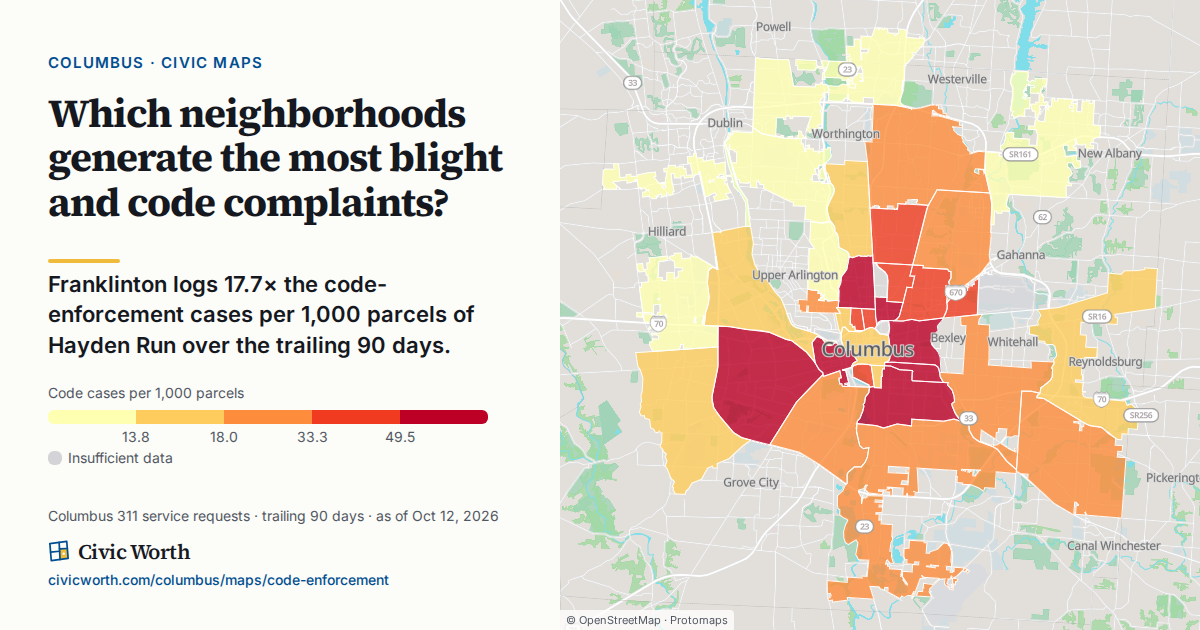
Why Your Columbus Neighborhood's Code-Complaint Numbers Might Say More About Your Neighbors Than Your Street
A Columbus code-enforcement complaint map shows how often problems are reported to 311, not how many problems exist or how the city responds; this post explains how to read the map correctly, where the City publishes case outcomes, and why the gap between reporting and resolution is a civic literacy issue, not a neighborhood judgment.
Read →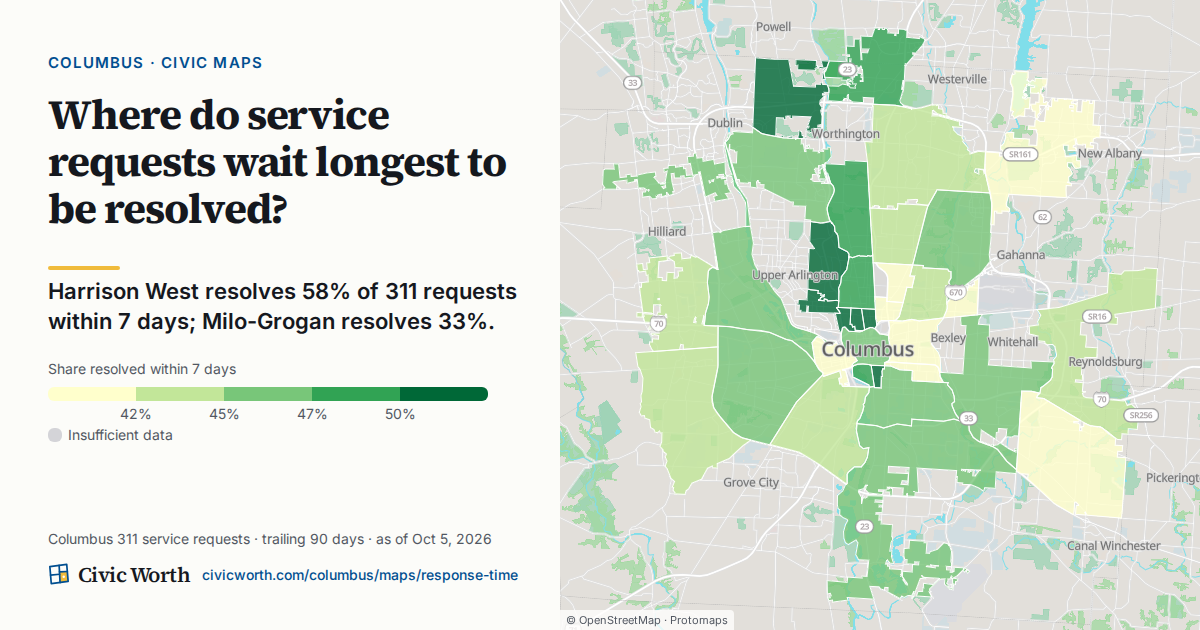
Same Complaint, Different Waiting Room: What Columbus 311 Response Times Actually Measure
A look at what the Civic Worth Columbus 311 response-time map actually shows (how fast requests close, by neighborhood) and what it deliberately won't tell you: why one block waits longer than another.
Read →
The Date on a Columbus Zoning or District Record Isn't a Footnote, It's the Whole Argument
A practical guide to checking the as-of date on Columbus zoning, variance, and council district records before citing them in reporting, testimony, or grant applications.
Read →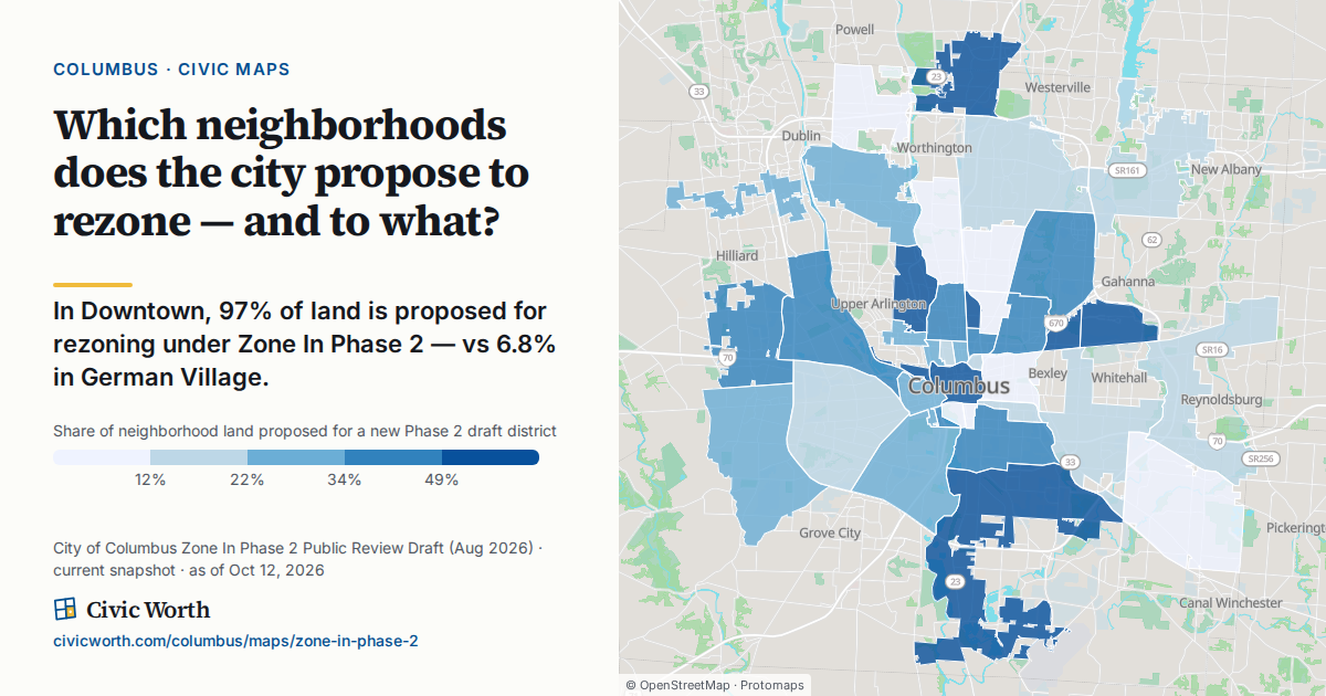
Columbus Zone In Phase 2 — What Would Change for Your Address
Columbus's Zone In Phase 2 draft reassigns the zoning district on much of the city. Here's how to read what it would do to one specific parcel — current district versus proposed — before the comment window closes.
Read →How to Check 311 Requests for Your Columbus Address
A plain-language guide to checking 311 request history for a specific Columbus address, how to read the pattern without over-interpreting it, and how that history connects to zoning, council district, and area commission context.
Read →How to Find What's Happening at Your Columbus Address Without a Records Request
Columbus publishes its zoning, variance, council-district, area-commission, permit and recent 311 data online, and Franklin County's Auditor publishes ownership. Here's where each piece lives, and what Ohio's Public Records Act says when you need a record that isn't online.
Read →How to Compare Zoning Variances Across Columbus Neighborhoods
Columbus publishes its approved zoning variances citywide in two map layers, each record with a case number, a status and a link to the case. Here's how to use them to look for patterns across neighborhoods, and what the records can't tell you.
Read →How to Look Up a Property's Zoning History Before a Columbus Variance Hearing
The City of Columbus publishes a parcel's zoning district, the case and effective date behind it, and mapped variance cases as public GIS layers. Here's how to read them before a hearing, and which body decides each kind of case.
Read →Why Is My Columbus 311 Request Taking So Long? How to Check Where It Stands
A Columbus 311 request's record shows which City department has it and what stage it's at, but not why it's taking as long as it is. Here's how to check yours, and how requests of the same type compare in the City's own data.
Read →What Your Block's 311 Record Can and Can't Tell You
The City of Columbus publishes the 311 requests opened in the last 30 days, each with its location, type, assigned department and status. Here's how to read that record for your block, and what it doesn't record.
Read →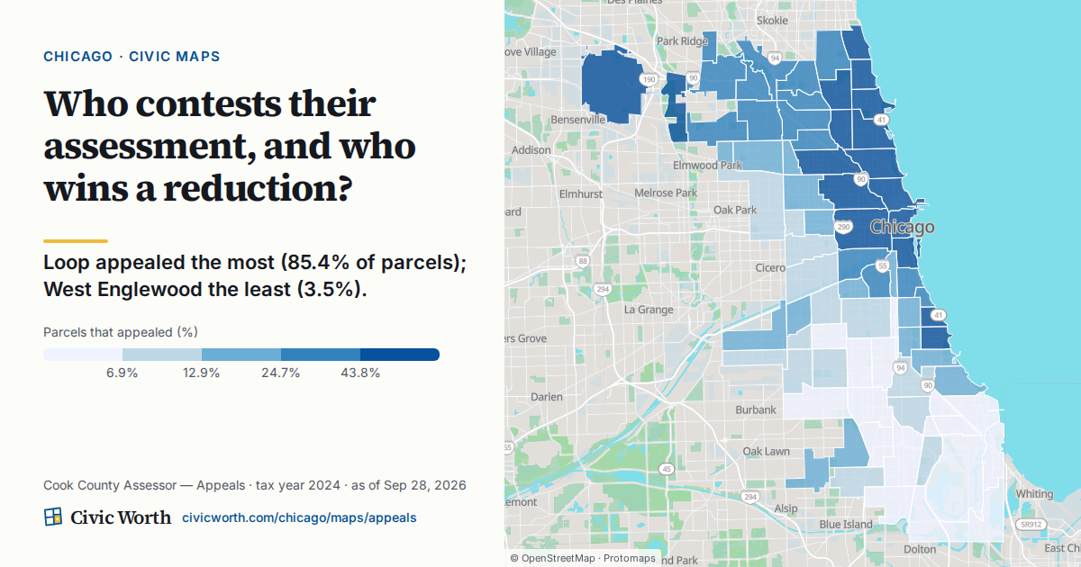
What a 14-Digit PIN Knows About Your Property
Every Cook County parcel has a 14-digit Property Index Number. It's the key that unlocks your assessment, ward, zoning, and more — here's what it opens.
Read →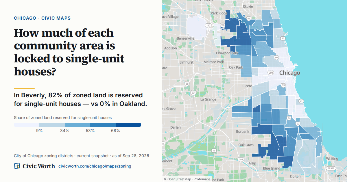
Is Your Chicago Lot ADU-Eligible? The Ordinance, as Data
Chicago's ADU ordinance reads like legalese. Here's how the rules become a per-parcel answer: the two eligibility paths, and how to confirm yours on the City's own map.
Read →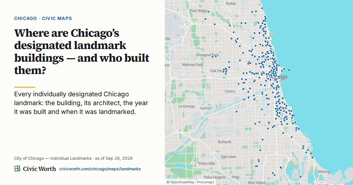
The Chicago Flag's Four Stars, and Why Civic Data Is the Fifth
Chicago's four red stars each mark a moment the city took stock of itself. Here's the history — and a small case for open civic data as a fifth.
Read →How to Read Your Block's Appeal Pipeline — Mailed vs. Certified vs. Board
Cook County publishes your assessed value at three stages — mailed, certified, and board. Here's what each one means and how to read your own parcel's progression.
Read →
What a Demolition Permit on Your Block Actually Tells You, and What to Do About It
A demolition permit on a Columbus parcel can mean an unsafe-building removal, clearance for new construction, or land banking, and telling those apart takes parcel-level records. Here's how to read them, and how residents can use the City's demolition review, including the area commission's 60 days to recommend.
Read →What 'Parcel-Resolved' Civic Data Actually Means
Most civic lookups stop at the ZIP code. Resolving everything to the parcel is what lets you answer questions about a specific address — not a neighborhood.
Read →