What a Demolition Permit on Your Block Actually Tells You, and What to Do About It
· Updated
A demolition permit on a Columbus parcel can mean an unsafe-building removal, clearance for new construction, or land banking, and telling those apart takes parcel-level records. Here's how to read them, and how residents can use the City's demolition review, including the area commission's 60 days to recommend.
Correction (October 3, 2026): An earlier version of this article said a demolition permit doesn't tell you why a building is coming down, and that a parcel with no variance applications means no one is trying to build. A demolition ordered by the City carries a Code Enforcement order number on the application, and construction that meets the existing zoning needs no variance, only a zoning clearance (City of Columbus Demolition Permit Application; Columbus City Code 3305.01). We also added the area commission's 60-day review of demolition permits (C.C. 4113.79(E)).
A demolition permit shows up on a parcel. Now what?
That single filing can mean very different things, and mixing them up leads to bad stories, bad grant applications, and bad decisions at area-commission meetings. Before any data interpretation starts, the distinction matters.
Common reasons a demolition permit gets filed, and why they are not interchangeable
First: an unsafe-building removal. The City can order an unsafe building repaired or demolished (Columbus City Code 4109.02, 4109.06), and an owner may take down a structure that inspectors have flagged. No follow-on development is guaranteed. The lot may sit empty for years.
Second: a clearance permit ahead of new construction. A developer demolishes an existing structure to make room for something new. In this case, look for a new building permit on the same parcel in the City's permit records; how soon one follows varies.
Third: land banking. A parcel is cleared and held for later use. The City of Columbus Land Bank says most of its parcels "will be held for ongoing community development and affordable housing projects," and the City maps its holdings (Land Redevelopment Properties layer). The goal may be to assemble adjacent lots over time, or simply to stabilize a block by removing a hazard. Nothing is coming soon. That is sometimes the whole point.
The permit usually won't tell you which scenario you are in, though a demolition ordered by the City carries a Code Enforcement order number on the application. You have to look at what surrounds it: the 311 history on that parcel, whether a new construction filing followed, and whether the owner of record is a land bank, an LLC, or an individual. Parcel-level resolution is what separates those three stories. A ZIP code average cannot.
How to read vacancy data alongside demolition activity
A vacant parcel may have a structure on it that is boarded up, or it may be a cleared lot. Vacancy itself is not a verdict. Context is.
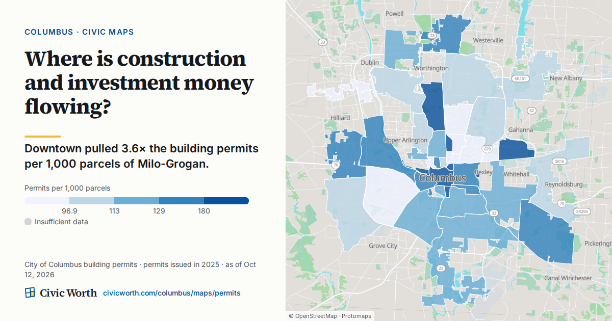
Here is the practical distinction: a block with five vacant parcels and no recent permit activity reads completely differently from a block with five vacancies and three active demolition filings. The first may be stagnation. The second may be the early phase of a capital project, a developer's assemblage, or a city-initiated blight-removal effort. They look similar on a satellite view. They are not similar.
Parcel-level data makes that difference visible. ZIP-code data smooths it away.
The indicators that separate disinvestment from development momentum
Neither vacancy nor demolition activity is a clean signal on its own. But certain patterns, read together, point in recognizable directions.
Disinvestment patterns tend to show:
- Consecutive vacancy years on the same parcel with no permit activity of any kind
- 311 complaint clusters: overgrown lots, illegal dumping, and structural complaints that repeat without resolution
- No building permits or zoning cases on or near the parcel (construction that meets the existing zoning needs only a zoning clearance, not a variance: C.C. 3305.01)
- Ownership records showing tax delinquency or multiple transfers at low values
Development momentum tends to show something different:
- A demolition permit followed within a reasonable window by a new construction filing on the same parcel
- Rezoning or variance cases on surrounding parcels (the City maps them in its Proposed Zoning Actions, BZA Zoning Variances and Council Zoning Variances layers)
- Area-commission meeting records showing project presentations from developers or the city
- 311 complaint volume dropping, or shifting from structural complaints to construction-noise complaints (a real sign that something is actually being built)
Neither list is a guarantee. Columbus neighborhoods are complicated. A single block can have parcels in both categories at the same time. The point is to read the indicators together, at the parcel level, before drawing any conclusions.
What residents and area-commission members can do right now
If there is ever a moment to pay attention to what is happening on your block and connect it to city processes, it is when a demolition permit appears.
Here is what you can actually do:
Flag a pattern to 311. If you see a vacant lot with overgrown vegetation, dumped materials, or a structure that looks unsafe, file a 311 request. Be specific: the address, not the intersection. Multiple cases on the same parcel over time tell a story that city staff and researchers can read.
Ask about the demolition review. Where your area has an area commission, it gets a copy of the demolition application and has up to 60 days to make a recommendation before the City can issue the permit (Columbus City Code 4113.79(E)). In a historic district or architectural review area, the owner needs a certificate of appropriateness first (C.C. 4113.79(B)). Before work starts, the site must be posted and owners within 125 feet notified at least 48 hours ahead (C.C. 4113.79(F), (G)).
Bring it to your area-commission meeting. Where your area has one, the area commission is a formal advisory channel: City Code gives it copies of applications for rezonings, variances and demolitions in its area (C.C. 3109.14(D)(5)). If you are seeing a pattern of vacancy or demolition activity on a block, bring the addresses. Ask whether those parcels are on any capital-project list, whether a land bank holds any of them, and whether any developer has approached the commission about the area. Those are answerable questions, and commissions can request that city staff respond.
Connect vacancy to capital-project timelines. The city maintains capital-improvement project schedules. A vacant or recently demolished parcel that sits adjacent to a planned infrastructure project is in a different situation than one that is simply abandoned. Knowing the project timeline, even just whether a project is funded and scheduled versus just proposed, changes how you interpret what you are seeing.
None of this requires a planning degree. It requires the right address-level data and the right questions.
How journalists and nonprofits can use Civic Worth for this work
Civic Worth joins more than 50 federal, state, county, and city public-records sources at the parcel level. For any Columbus address, the free preview shows council district, area commission, zoning, and building permits and 311 requests within 200 meters, in under a second. Every fact carries its source and an as-of date, not a summary with no trail, but a traceable record.
For verified Columbus newsrooms and 501(c)(3) nonprofits, Civic Worth offers up to 100 free reports per month through its newsroom and nonprofit access tier. For journalists working a neighborhood story: that is parcel-level sourcing you can cite, before you publish. For nonprofits building a grant application around place-based conditions: that is the documented, dated evidence that funders ask for.
A few specific ways the data is useful for this kind of work:
- Pulling recent 311 requests near a set of addresses to document conditions on a corridor before a grant deadline
- Cross-referencing demolition permit activity against zoning status to determine whether the cleared parcels are in a zone that would allow the proposed new use
- Identifying which council district and area commission represent a cluster of addresses, so you know exactly who to contact and who has jurisdiction
- Verifying that the address you are writing about is in the council district you think it is, not the adjacent one (Columbus district boundaries are not always obvious)
Grant cycles have deadlines, and a demolition application gives the area commission 60 days to respond. Parcel-level data that takes a second to pull does not need to be the bottleneck.
One address at a time
A demolition permit is a public record. A vacant lot is visible from the sidewalk. What is harder to see, without the right data, is what those two things mean in combination on a specific parcel, on a specific block, in a specific Columbus neighborhood, right now.
That is the question Civic Worth is built to answer. Look up any Columbus address at civicworth.com to see nearby permits and 311 requests, its zoning, and its council district in one place. Free preview, no account required.
If you are seeing something on your block and you are not sure what it means, start there.
Sources
- Columbus City Code, Section 4113.79: Demolition permit
- Columbus City Code, Chapter 4109: Unsafe Buildings and Conditions
- Columbus City Code, Section 3305.01: Certificate of zoning clearance
- Columbus City Code, Chapter 3109: Area Commissions
- City of Columbus, Demolition Permit Application
- City of Columbus Land Bank, General Land Bank Policies (July 2024)
- City of Columbus, map layers: Building Permits and Land Redevelopment Properties
- City of Columbus, map layers: BZA Zoning Variances, Council Zoning Variances and Proposed Zoning Actions
Frequently asked
What can a demolition permit mean?
Common cases include a City order to repair or demolish an unsafe building (C.C. 4109.02, 4109.06), clearing a site for new construction, and clearing a lot that a land bank then holds for later redevelopment. The permit alone usually won't tell you which, though a demolition ordered by the City carries a Code Enforcement order number on the application.
How do you tell the difference between a demolition for development versus disinvestment?
Look at the parcel's records together: recent 311 requests nearby, whether a new building permit follows on the same parcel, and the owner of record (a land bank, an LLC, or an individual). Parcel resolution separates these stories; ZIP-code averages cannot.
Why is parcel-level data more useful than neighborhood or ZIP-code data?
A single demolition permit can mean very different things. Parcel-level resolution allows you to examine nearby 311 requests, subsequent permits, and ownership details—providing clarity that broader geographic averages cannot offer for accurate interpretation.